Exclusive marine cartography of Garmin, which provides detailed maps and all the necessary information to navigate.
The digitized images are very similar to the reading of a letter, which facilitates the reading information.
It is possible to acquire it in engraved cartridges or in a CD ROM that contains information of whole Europe and, also, we can select the area we want to unload in the plotter.
A - For the series Map and eTrex – CD Rom BlueChart
The cartography BlueChart works with a wide variety of Garmin plotters and offers compatibility with several models of portable GPS. The different areas turn out to be shaded in a very similar way to the traditional letters of paper, facilitating the identification of slightly deep waters areas, outlines of depth and much more. Available for America, Atlantic Ocean and Pacific Ocean. Versions: small, regular and large.
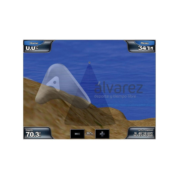
B - For the series 400 and 500 – cartridges G2 Vision
The most recent in electronic nautical cartography for Garmin plotters. Besides detailed letters of the BlueChart g2 cards, the new cartography BlueChart g2 Vision incorporates high resolution satellite images, 3D superficially perspective and below the waterline, Autoguidance Route function, aerial photos and coastal road maps with interesting points. Versions: small, regular and large.